Pioneer Information
Born in Hanover County, Virginia, Christmas led a distinguished career as a surveyor, cartographer, legislator, and militia and civil officer. In 1757 the Christmas family moved to North Carolina. Though Christmas’ educational background is unknown, it is believed that he trained as a surveyor under General Thomas Person, surveyor of the Granville District (a segment of the North Carolina colony).
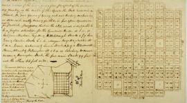
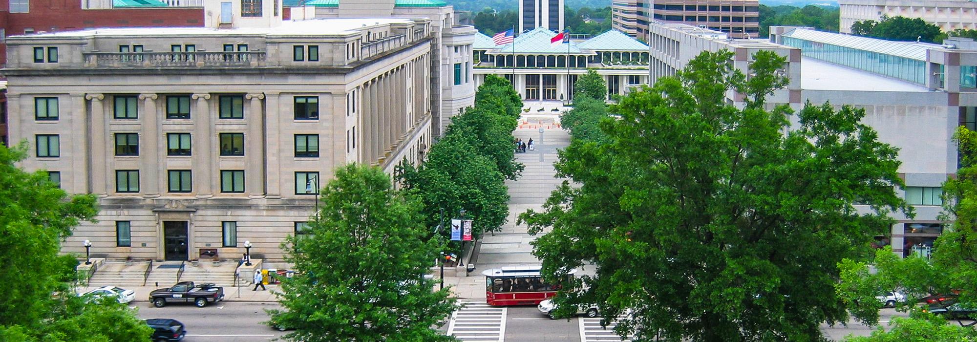
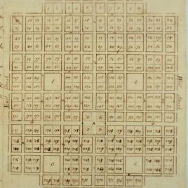
Christmas served in the militia during and after the Revolutionary War, following in the footsteps of his father, John Christmas, a military captain. In 1787 he moved to Franklin County, North Carolina, and was appointed second major of the militia there, rising in the ranks to become lieutenant colonel commandant in 1795, a position he held until 1800. Christmas also served the state legislature in Franklin County as a juror, tax collector, and bridge commissioner, as well as county surveyor. In 1789 he voted in favor of ratifying the U.S. Constitution, and in 1792 was elected to the North Carolina state senate. That same year, Christmas embarked on the most prominent project of his career, the development of the plan for the new capital city of Raleigh on a 1,000-acre plot of forested land in the center of the state. He created a one-square-mile grid modelled on William Penn’s Philadelphia Plan, with the axial center of the city as Union Square (now Capitol Square) at the intersection of four major avenues.
Christmas also helped create the first map of North Carolina sourced from surveying, the Price and Strother Map (1792). His career as a surveyor extended to South Carolina, Georgia, Kentucky, and Tennessee, where he was appointed surveyor general in 1800. Christmas died in Williamson County, Tennessee, at the age of 57.