
Photograph © Craig Grant
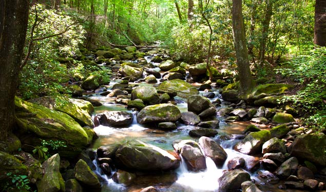
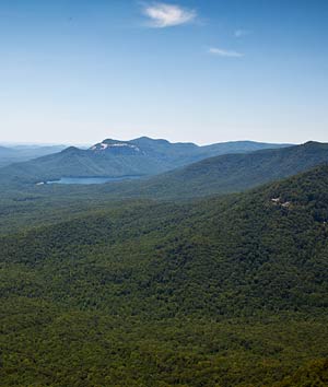
The Blue Ridge Escarpment—aptly called the Blue Wall, by the Cherokee Indians—is a unique segment of the Blue Ridge Mountains. The Blue Wall contains more than fifty waterfalls, the largest concentration in the eastern United States, including several with drop-offs more than 300 feet…Lake Jocassee is a crown Jewel of the many lakes, large and small. — C. Thomas Wyche
History of Blue Ridge Escarpment

Photograph © Craig Grant
By the time of European arrival during the 18th century, the Cherokee had already developed an extensive community throughout the southeastern part of the country, including the region they called "the Blue Wall." As English settlers established villages at Jocassee and Keowee Lakes, along existing trails, they pushed the Cherokee from the Blue Wall region. After the Cherokee War of 1776 and inevitable displacement of the remaining tribes, the land was ceded to South Carolina. By the mid-19th century, mills, schools, stores, and farms populated the former expanses of Indian land. Forests were cleared for pasturelands and timber harvesting, waterways were diverted to isolated settlements, and wildlife was hunted out of existence. As natural resources became scarce, the settlers’ population boom ended and quickly declined.
Timber companies continued to harvest the forests, cutting entire stands of old-growth hardwood. Affiliated energy companies sought the area's resources and in the 1960s, were undertaking massive projects in the region, including hydroelectric facilities. During this time, steward C. Thomas “Tommy” Wyche, spent nearly every weekend, hiking, canoeing, and photographing the Blue Wall. The geological feature is the result of an abrupt end to the Blue Ridge Mountain range. The elevation drops by 2,000 feet in less than half a mile, creating a spectacular showcase of cliffs, gorges, and waterfalls and providing habitat for more than 400 rare plants and more species of trees than in all of Europe. In 1787, famed botanist Andre Michaux discovered the Oconee bells (Shortia galacifolia), a rare plant species that is a hallmark of the Jocassee Gorges, during the first of many botanical studies that would document the flora-rich qualities of the region.
Mr. Wyche established Naturaland Trust, a land trust organization, in 1972, to spearhead the efforts to preserve the Blue Wall in North and South Carolina an area of over 90,000 acres, that stretches about 80 miles from the Chattooga River on the west to Greenville County on the east. Major tracts included the Jocassee Gorges, a 50,000-acre tract owned by Duke Power Company, and two watershed properties -- 19,000 acres around the Poinsett Reservoir and 10,000 acres around the Table Rock Reservoir, owned by the Greenville Water System. He began a two-year long letter-writing campaign to company and county officials urging preservation of the lands.
Unable to make headway with the largest landowners, Mr. Wyche turned toward other landowners. Between the Table Rock and Poinsett Reservoirs was about 12,000 acres of land in private ownership, now known as “the Mountain Bridge.” Over a period of 15 years, he met frequently with almost every owner, making full use of his expertise in tax law and estate planning and ultimately convinced most to make a donation to the State of South Carolina, which now manages the properties as wilderness parks and heritage.
During that time, Mr. Wyche also convinced the Water Commission to study the watershed properties. A committee was established to undertake a detailed scientific study, which determined the significance of the watershed areas to the greater region. The result was a conservation easement established in 1993, through The Nature Conservancy, to permanently protect all 29,000 acres of the watershed lands. At the time it was the largest conservation easement ever received by The Nature Conservancy in the eastern United States and the fourth largest in the nation.
Since that time, Mr. Wyche returned his attention to the spectacular 50,000-acre Jocassee Gorges property, owned by Duke Power. Relying on his skills as a nature photographer and his intimate understanding of the landscape, he published two books of photographs featuring the Blue Ridge Escarpment, South Carolina's Mountain Wilderness: The Blue Ridge Escarpment and The Blue Wall: Wilderness of the Carolinas and Georgia. The stunning views captured in the books, acted as a virtual tour of the landscape and played a significant role in procuring much needed awareness of the site’s significance. The result was a major challenge grant from the Richard Mellon Foundation which, in 1998, North and South Carolina accepted and provided the balance of the funding needed to acquire and protect the entire property.

Photograph © Craig Grant
Threat
South Carolina is one of the fastest growing states in the U.S. The unique and extensive natural landscape as well as the region's proximity to the cities of Atlanta and Charlotte, has made the area a popular location for second homes. While these lands are now under the protection of private ownership, their future is not assured. Urban sprawl and development of recreational facilities is a constant threat. A more particular affect is the invasion of non-native species that threaten the ecological balance. As people seek ways to escape the nearby cities, more and more second homes are being constructed in the vicinity of the Blue Ridge Escarpment. Incompatible construction continues to threaten still unprotected lands.

