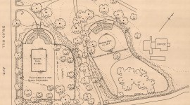
Landscape Information
Established in 1805, the Faubourg Marigny was the first neighborhood to develop downriver from the Vieux Carré during a time of increasing immigration and American investment in New Orleans. It quickly became home to many Creoles, free African Americans, and working-class Irish and German immigrants. The land was originally part of a plantation belonging to Bernard de Marigny de Mandeville, who hired Nicholas de Finiels to plat the area. Esplanade Avenue serves as the border between the Vieux Carré and the Faubourg Marigny neighborhood, which extends to Franklin Avenue to the west, St. Claude Avenue to the north, and the Mississippi River to the south. Well-preserved Creole and Classic Revival cottages sit beside shotgun-style houses throughout the neighborhood, serving as reminders of its historical and cultural diversity. In keeping with Finiels’ original plan, Washington Square is the primary public space.
At nearly five miles long and comprising a wide, grassy median lined with oaks, crepe myrtles, and palm trees, Elysian Fields Avenue cuts through the middle of the neighborhood, envisioned by Marigny as its primary thoroughfare. Though it never developed into the grand promenade Finiels imagined, the avenue crossed tributaries of Bayou St. John, the Gentilly Ridge, and marshland to connect the Mississippi River to Lake Pontchartrain, creating an industrial corridor and hosting the Pontchartrain Railroad from 1831 to 1935. Faubourg Marigny was designated a National Historic Landmark District in 1974.