Landscape Information
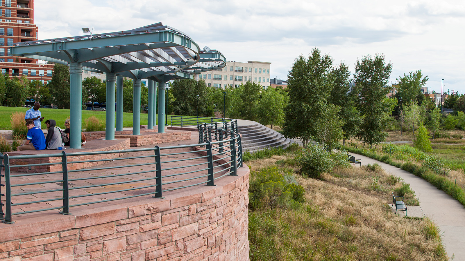
This 20-acre park lies just north of the confluence of Cherry Creek and the Platte River, a landscape significant as a historic gathering place for Native American tribes and the location where gold was discovered in 1858. More than a century later, structural remnants from former industrial uses occupied the largely vacated brownfield owned by the Burlington Northern Railroad. In 1991, the Trillium Corporation purchased the land, engaging Design Workshop to develop a revitalization plan for the Central Platte River Metropolitan District. The corporation sold a portion of that property to the City of Denver for development as a park. Civitas, with Jones & Jones Architects and Landscape Architects, restored forty percent of it as riparian habitat and designed the remainder as urban parkland with shade structures, seating areas, and recreational fields while Design Workshop developed pedestrian connections into the park.
The park attracts users from the South Platte River Trail stretching over 17 miles to the north and south, and Denver’s 67-mile greenway system. The parcel comprises three distinct areas: a tree-lined promenade lined with benches flanks Little Raven Street where plazas denote entry points; wetlands with cottonwood and willow on the river accommodate stormwater; and centrally located lawn areas bounded by interconnected curvilinear pathways. A 40-foot-diameter black marble stone compass orients visitors while a serpentine stone sculpture overlooks the terraced retaining wall and pavilion to the southwest, providing sweeping views of downtown skyscrapers and the restored riverbanks. Two pedestrian bridges, Millennium Bridge and the Platte River Bridge, foster connections across the South Platte.