


Landscape Information
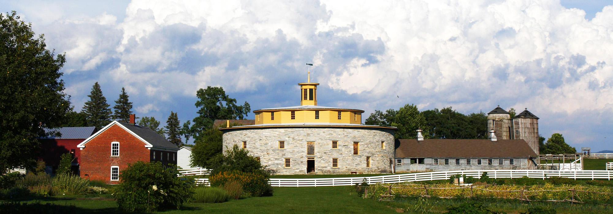
Established in 1783, this 3000-acre Shaker village was the third of 19 between New England and the Mississippi River. The village was modeled after the Shaker community in Mount Lebanon, New York, where residents were divided into family units with gardens, a dwelling, a meetinghouse, and ancillary structures. Hancock encompassed six units, arranged on north-south and east-west axes, and around 1840 it housed 300 people. By 1960 the population was greatly diminished and much of the property sold. Its remaining 1000 acres and 20 extant buildings were purchased by Hancock Shaker Village, Inc., which restored the historic structures and opened the village as a living history museum in 1961.
Today, Hancock Shaker Village straddles U.S. Route 20, with the majority of community structures and gardens located south of the highway. The current Visitor Center was constructed in 2000 at the west end of the property, with extensive working gardens built in the 1960s extending east towards the historic buildings. The buildings are intermixed with fenced paddocks and smaller gardens, sited and planted according to historic research and oral histories conducted with the last Shakers living there. Winding paths weave through the structures and mature shade trees line the highway and agricultural fields to the north. Fourteen of the original structures have been restored, including a unique 270-foot wide circular stone barn built in 1826. A historic cemetery, nineteenth-century water system, and a ceremonial mound are also included in the cultural landscape. The village was designated a National Historic Landmark in 1968.


