Landscape Information
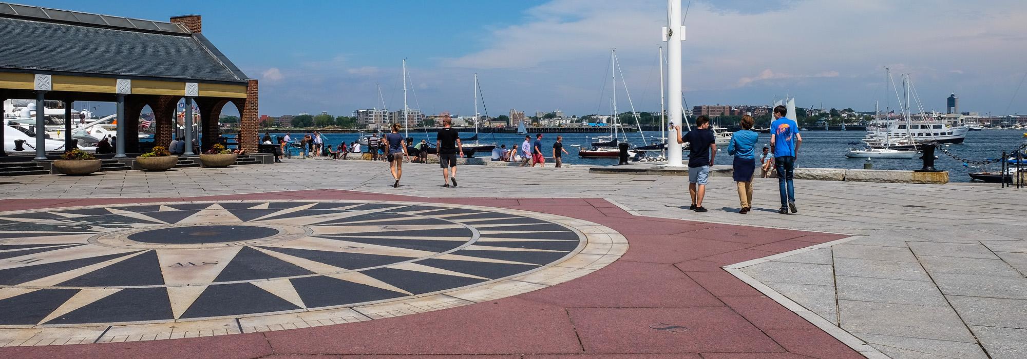
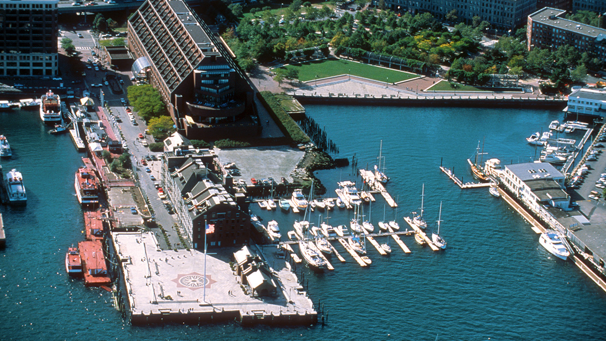
Originally built in the 1710s, this pier once extended from State Street in downtown Boston a half-mile into Boston Harbor. Before being shortened by infill, Long Wharf helped solidify the city as an important shipping destination. The wharf became further disconnected from downtown by an elevated highway constructed during the 1950s. This spurred concerns over the future of Boston’s waterfront and resulted in its redesign by Sasaki, Dawson & DeMay. The firm was commissioned by the Boston Redevelopment Authority in 1974 and prepared and oversaw the implementation of a master plan in 1979. The project involved the installation of a promenade along the remaining length of the pier, terminating in an open plaza that features decorative granite and bronze paving at its center in the form of a compass. To the north of this focal point is an open-air structure surrounded by planters and benches. The project also included the restoration of granite bulkheads and the introduction of furnishings, including granite slabs for seating and nautical-themed bollards and chains. A towering mast and flagpole acts as a beacon, visually connecting the pier with the city. The Harborwalk runs along the southern edge of Long Wharf, transitioning from a boardwalk to stone paving at the open plaza.
The project is visually and physically linked with Christopher Columbus Waterfront Park, designed by the same team in 1976. Long Wharf was listed in the National Register of Historic Places and designated a National Historic Landmark in 1966.