On February 19, 1942, two months after Japan attacked the U.S. naval base at Pearl Harbor, President Franklin D. Roosevelt signed Executive Order No. 9066, giving the military authority to remove persons, at its discretion, from an area bounded by the full length of the West Coast of the United States and extending nearly 100 miles inland. Although the order did not specify who was to be targeted, the U.S. Army forcibly removed the entire population of people of Japanese descent in that area, confining them in perpetually guarded camps established in remote areas of seven states. It is estimated that more than 120,000 people of Japanese ancestry, two-thirds of them U.S. citizens, were rounded up and confined in the camps, many for the duration of World War II.
History
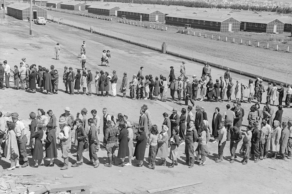
Acting soon after Roosevelt’s Executive Order, Lt. General John DeWitt issued a series of proclamations that established various zones near the coast as “Military Areas.” The proclamations informed the public that certain residents may be required to leave those areas upon further notice. In March 1942, the War Relocation Authority, an independent federal agency, was created to administer the removal of people of Japanese ancestry from the designated Military Areas. DeWitt would issue the first official Civilian Exclusion Order on March 23, 1942, setting off a chain of relocation efforts all along the West Coast (he would issue more than 100 such orders over time). Families reported to collection centers near their homes, then to regional assembly centers (where they typically remained for several months) before final transport by train to one of ten War Relocation Centers established in rural areas of California, Arizona, Colorado, Wyoming, Idaho, Utah, and Arkansas. While some government administrators believed that detainees could be quickly resettled from the designated Military Areas into civilian life elsewhere, anti-Japanese sentiment in the western states proved strong, with governors insisting that the any resettled Japanese Americans entering their states be kept under guard.
"The justification for the removal was ostensibly to thwart espionage and sabotage, but babies, young children, the elderly, the infirm, children from orphanages, and even children adopted by Caucasian parents were not exempt from removal. In all, over 17,000 children under 10 years old, 2,000 persons over 65 years old, and 1,000 handicapped or infirm persons were removed."
 Barracks at the Poston War Relocation Center, 1942, photo courtesy the Natiional Archives.
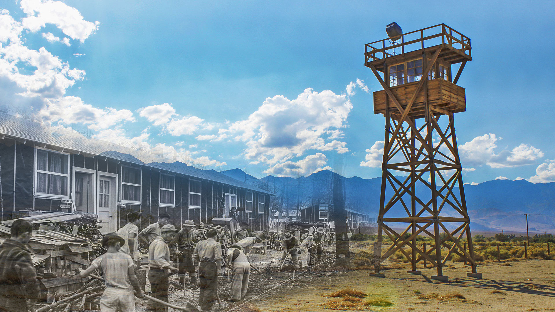
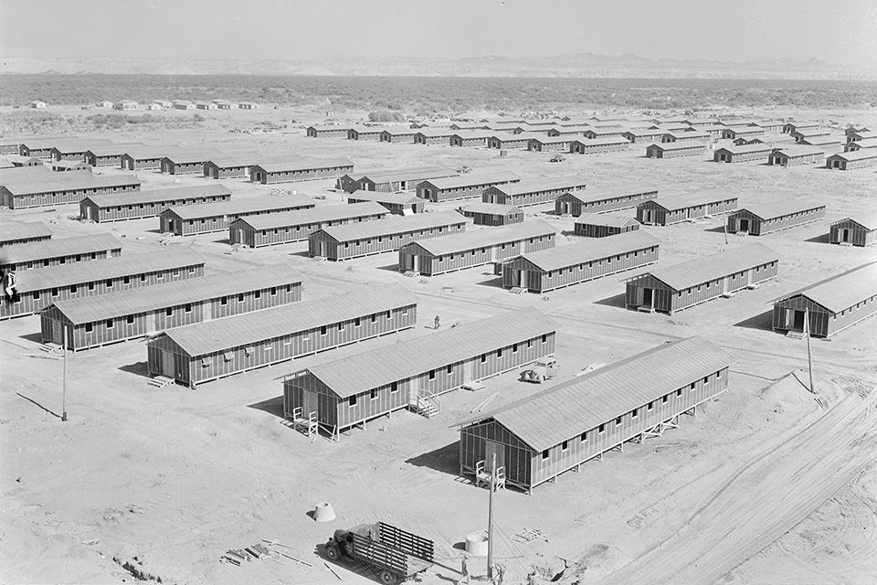
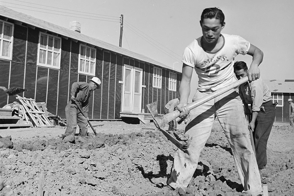
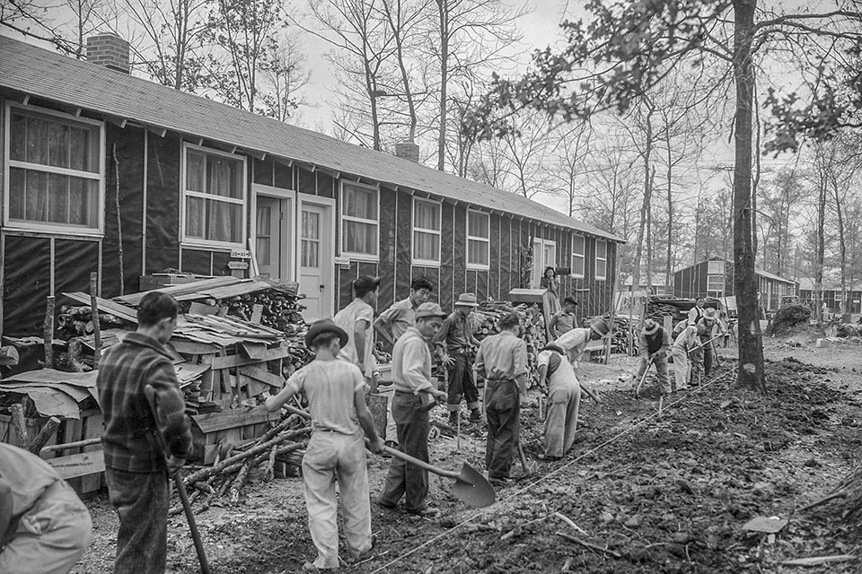
All ten of the long-term confinement sites (or camps, as they were called) were established in rural areas, some of them immediately becoming the largest de facto towns in their sparsely populated states. The camps had hospitals, schools, factories, and other staple features of towns, but all usually enclosed within a circuit of barbed-wire fencing punctuated by guard towers. The most recognizable features of the camps were the identical rows of makeshift barracks where detainees were housed, laid out in a grid system divided into blocks (12-14 barracks per block). The barracks were separated by fire breaks, and each block also contained a mess hall, latrines, laundries, and a recreational center. The wood-framed barracks, each approximately 20 x 120 feet, were partitioned into small apartments that housed entire families; each apartment had a single drop light, a heating unit, and cots.
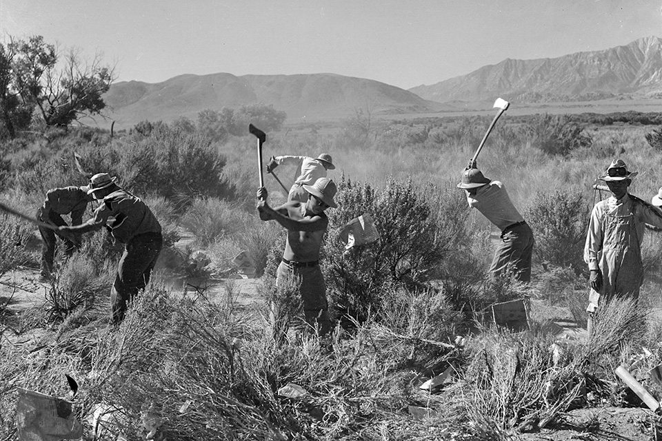
This residential core of barracks and support buildings was surrounded by hundreds of acres of open land where detainees toiled to grow food and raise animals, making the communities largely self-sufficient. In addition to building their own shelter and furniture, detainees often prepared the land for farming, digging extensive irrigation channels and drainage ditches. The camps also contained various forms of industry—mills, garment factories, woodshops, etc.
Because of war-time labor shortages, a small percentage of detainees was permitted to leave the camps to work in large-scale agricultural production, and some students were permitted to leave to finish their collegiate studies. Many second-generation Japanese Americans (Nisei) housed in the camps volunteered for military service, enlisting in what would become the combined 100th Battalion/442nd Regimental Combat Team, which earned the distinction of becoming the most decorated unit in the history of the U.S. Army for its size and length of service. Of the 14,000 men who served, 9,486 received Purple Hearts, and 21 were awarded the Presidential Medal of Honor.
View a portion of an interview with San Diego-based landscape architect Joseph Yamada, who was confined at the Poston War Relocation Center as a child.
Despite the daily routine and activity, a life of confinement in the camps took its toll. Privacy was for the most part completely absent, and the highly traditional structure of Japanese family life was capsized. In addition to restricting their movements, the WRA also restricted the detainees’ use of the Japanese language. Most camps, which provided only rudimentary protection from the elements, were located in areas with widely varying temperatures, from blazing heat to severe cold, and the barren landscapes were often reduced to large tracts of dust or mud, depending on the weather. To improve their lives, the detainees beautified their surroundings, planting numerous trees and flowers and creating ponds, pools, and all manner of gardens—even Victory Gardens. Remnants of many of these features are still visible in the landscapes today (see below).
On January 2, 1945, the War Department officially lifted the orders excluding certain individuals from areas of the West Coast. By fall, most of the camps had closed, with many of the buildings sold to returning war veterans or local municipalities. The War Relocation Authority was disbanded on June 30, 1946. But even after the camps were closed, the detainees’ difficulties were not over. Approximately half of them returned to the West Coast, and many were greeted with violence and discrimination upon their arrival. The process of finding new housing and new work—in essence, a new life—was often not an easy one, not least because families had lost nearly everything when originally uprooted. Many detainees chose to settle in new places, with large numbers of them eventually residing in Chicago, Denver, and Salt Lake City.
In 1980 President Jimmy Carter established the Commission on Wartime Relocation and Internment of Civilians. The report issued by the commission concluded that the decision to incarcerate was based on "racial prejudice, wartime hysteria, and a failure of political leadership."
 Detainees working in the surrounding fields, Manzanar War Relocation Center, CA, photo by Dorothea Lange, 1942.
The work of the commission led to the passage of the Civil Liberties Act of 1988, signed into law by President Ronald Reagan. The Act issued an official apology and recognized the unfair treatment and confinement of people of Japanese ancestry during World War II, establishing restitution payments and a public education initiative to chronicle and communicate the plight of those who were unfairly treated by the United States government.
The Camps and the Threat Today
In 2006 Congress authorized $38 million to fund the Japanese American Confinement Sites grant program, signed into law by former President George W. Bush. The program is administered by the National Park Service with the goal of preserving and interpreting the history of the wartime incarceration of Japanese Americans. For more than a decade, that program has provided some $21 million to date to support documentary and preservation efforts, including conducting oral histories with survivors, creating books, films, museum exhibitions, educational programs, and interpretive memorials, along with many other initiatives.
But for the past two years, the latest presidential administration has submitted budget proposals that have sought to greatly diminish—or altogether cancel—funding for the program. Only through strenuous public-awareness campaigns have advocacy groups been able to restore the full levels of appropriations, with funds initially cut in half in the FY2018 budget request and altogether declined for FY2019. This has signaled to many that, in the future, the full funding of the program will entail an annual struggle for appropriations, despite the public law that has set aside the funds for a highly successful program that has made possible 195 projects to date in 18 states and Washington, D.C.
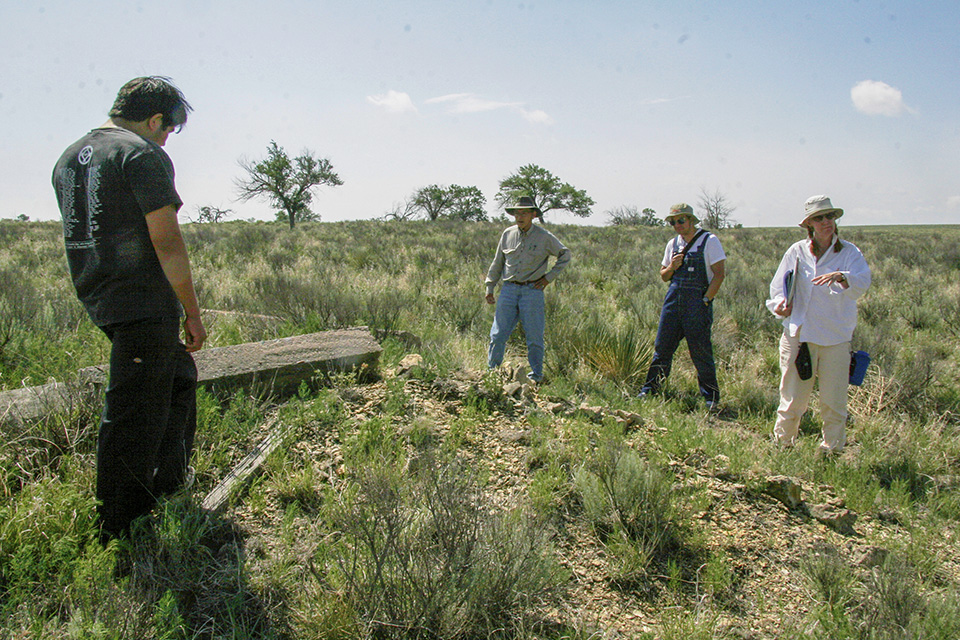
In the meantime, the remains of many of the ten confinement sites and their landscapes continue to languish. Some sites, such as Camp Amache, have been severely damaged by inclement weather and need repair. The remnants of other sites are routinely vandalized, while still others have been parsed by the sale of their lands. Because many of these significant cultural landscapes are in remote locations, there are few opportunities for support from tourist dollars, and much greater effort is needed to make the public aware of their existence.
Below is a list of the ten confinement sites and a brief account of what remains of each.
 Manzanar War Relocation Center
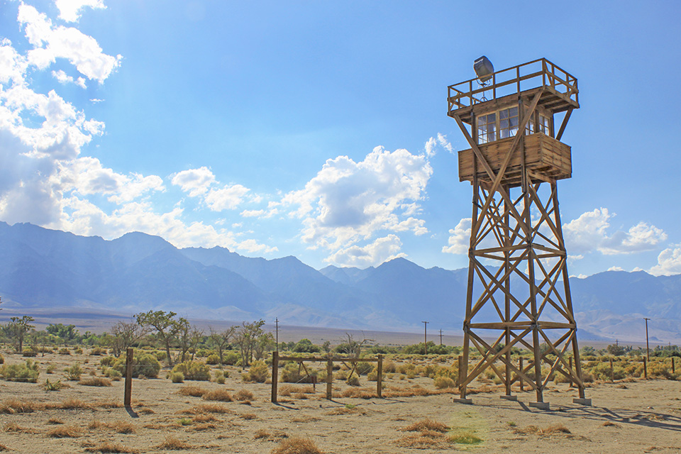
The Manzanar War Relocation Center opened in March 1942 and was the first of the camps to receive detainees. Located just south of Independence, California, near the eastern border of the state, it housed a population of just over 10,000 in a landscape that was largely desert scrub. The residential portion of the camp stretched over nearly 550 acres, where detainees made sidewalks, paths, playgrounds, and even planted Victory Gardens. Other ornamental gardens may have made use of the Japanese landscape principle of shakkei (“borrowed scenery”), while an area of the camp known as Rose Park had flower beds, two small lakes, and a Japanese tea house. Hundreds of acres around the camp were cleared for farming, which included the raising of chickens. A factory producing camouflage nets for the military also operated in the camp.
Manzanar is regarded as the best-preserved of the ten confinement sites. When it closed in November 1945, nearly all the structures were cleared away, and the site was returned to City of Los Angeles, to which it had belonged. The remnants of a few structures do, however, remain, showing pagoda-style roofs and other Japanese stylistic elements. Original sidewalks, foundations of barracks, and several landscape features are also present. The latter include gardens, paths, concrete ponds, a fountain, wading pool, an arbor, and fences. Eleven Japanese gardens and ponds have been excavated to date. The surrounding fields where detainees once toiled are now mostly abandoned, but many original irrigation ditches are still evident.
Manzanar was added to the National Register of Historic Places in 1976 and became a National Historic Landmark in 1985. The Landmark designation includes some 640 acres, including the landscape comprising the residential compound once enclosed by barbed-wire fencing and punctuated with eight guard towers. It also includes the camp’s cemetery just beyond the fence, with a monument erected by detainees in 1943. Manzanar became a National Historic Site in 1992. Today, the National Park Service operates a museum in the restored Manzanar auditorium. A reconstructed guard tower and a recreated barrack add to the exhibits on the site for visitors.
 Minidoka War Relocation Center
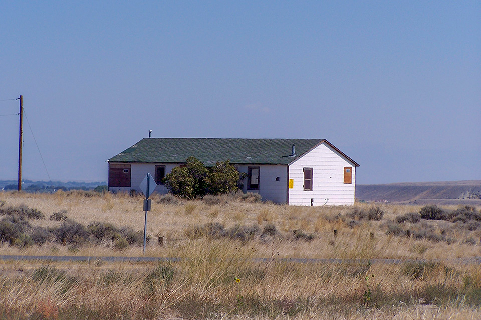
The Minidoka War Relocation Center was established in the high desert of south-central Idaho’s Snake River plain, twenty miles northeast of Twin Falls. The camp opened in August 1942 and closed in October 1945, housing more than 9,300 detainees from Oregon, Washington, and Alaska. The detainees were initially tasked with preparing some 1,500 acres of land for agricultural purposes, but rather than work that land, they instead worked on several large farms in the area, which had lost workers due to the military draft. Detainees were also deployed to help build the Anderson Ranch Dam, a large earthen and rockfill dam eventually completed in 1950. When military service became available to some Japanese Americans, nearly 1,000 men and women from Minidoka joined the service. Two individuals earned a Medal of Honor, and 73 were killed in action, representing the largest number of combat casualties from any of the confinement sites.
The camp was established in the form of a town. It had a high school, a junior high school, and two elementary schools, as well as a wide variety of shops and services, including two fire stations. Detainees at the camp cultivated vegetables on a large scale, along with raising hogs and chickens. They built several recreational facilities, including nine baseball fields and two swimming pools, and created a park with picnic grounds, as well as a cemetery. Burials in the cemetery ceased after the war, and the remains of the interred were moved elsewhere.
The original residential and administrative area—covering nearly 1,000 acres—was mostly converted to private land after World War II, offered as homesteads to veterans. Most of the land is now used for grazing or agriculture. Several former camp structures are located on private farms within the former boundaries of the camp, and many of these have been altered or moved from their original locations. The Bureau of Reclamation (BOR) was left with 84 acres on the northeast side of the North Side Canal that includes some ruins of buildings. This portion of the site was added to the National Register of Historic Places in 1979 and became a National Historic Site in 2008. The site today encompasses 407.5 acres. An original fire station, warehouse, root cellar, several foundations, and the remains of the entry guard station are available for public viewing. In addition, an original barrack and mess hall from block 22 have been returned to the site. Reconstructions include a guard tower, a baseball field, and the Honor Roll honoring Japanese American veterans from Minidoka. A visitor center is planned to open in 2019 in a restored warehouse.
 Rohwer War Relocation Center
The Rohwer War Relocation Center, located in the Mississippi Delta region of southeastern Arkansas, was one of only two confinement sites established in the eastern United States (the other was the Jerome confinement site 27 miles to the south). Opened in September 1942, Rowher housed some 8,500 people, with 500 acres allotted to the camp’s main detention area and 600 acres cleared for farming, which included raising hogs and chickens. A significant remnant of the camp is the Rohwer Relocation Center Memorial Cemetery, designed and built by the detainees. Occupying a rectangular plot, it covers less than an acre but contains 24 grave markers, a bench, a flagpole, sidewalks, and two entrance markers. The cemetery is also home to two commemorative monuments. One monument, established in 1944, is dedicated to the 24 people who died while living in the camp; the other was erected in 1945 and dedicated to the Japanese Americans serving in the combined 100th Regiment and 442nd Regimental Combat Team, a highly decorated military unit. In 1994 seventeen cherry trees were planted to recall part of the original design of the cemetery, which is one of only three surviving cemeteries from the confinement camps.
After the Rohwer camp closed, 120 acres of the site were deeded to the local school district, with the remaining land sold to farming operations. Some 363 acres of the original site were added to the National Register of Historic Places in 1974, and the cemetery became a National Historic Landmark in 1992. Many buildings and structures remain standing in the portion of Rohwer that was not designated an NHL.
 Jerome War Relocation Center
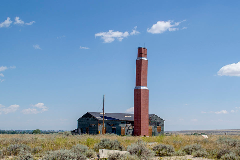
The Jerome War Relocation Center opened in October 1942 and would house some 8,500 detainees. The main camp was established on 500 acres (purchased by the Farm Security Administration) of marsh floodplain approximately 120 miles southeast of Little Rock, Arkansas, near the small town of Jerome. The site was heavily forested, so detainees were forced to clear large swaths of the land for farming. They created an extensive drainage system, growing vegetables on several hundred acres. The Jerome camp closed in June 1944 (the first of the ten camps to do so), with some 5,000 of its remaining detainees transferred to other centers, many to the nearby Rohwer camp, which was connected to the Jerome site via railway. Jerome was then used to house German prisoners of war, who were not made to toil in the fields as had the U.S. citizens who formerly occupied the site.
Today, the site of the Jerome camp is privately owned farmland. Of the hundreds of structures built to service the camp, only two houses remain, along with the smokestack of the hospital’s incinerator. The foundations of some camp buildings are, however, visible, and roads constructed for the center are still in use.
 Granada War Relocation Center
The Granada War Relocation Center opened in southeastern Colorado in August 1942, just one mile from the small town of Granada. To eliminate confusion for the postal service (which already had a post office in Granada) the camp was commonly called “Amache,” the name of the daughter of Cheyenne Indian Chief Ochinee who married John W. Prowers (1839-1884), for whom Prowers County, where the camp was located, was later named. The smallest of the ten camps, it housed approximately 7,500 detainees on land purchased from local farmers. Of the nearly 10,000 acres claimed for the camp, approximately 650 acres were used for the residential and administrative center, the remainder devoted to agriculture and livestock. The historic road network, as well as foundations of many buildings and the standing remains of a few others, can still be seen today. A cemetery, containing a granite memorial and a ten-foot-high stone monument, remains in what was the southern portion of the main residential area. Excavations conducted by Dr. Bonnie Clark found evidence of the gardens and landscapes designed and implemented by detainees, which may have included the use of shakkei (“borrowed scenery”).
After the camp closed in October 1945, much the agricultural land was sold to local farmers, while the residential compound became part of the Town of Granada, its well forming part of the town’s water supply. Some 593 acres of the original confinement site were added to the National Register of Historic Places in 1994 and designated a National Historic Landmark in 2006. The site today includes a reconstructed barrack, water tower and guard tower. An original recreation hall was returned to the site in 2018. The Amache Museum in nearby Granada is also open to visitors.
 Heart Mountain War Relocation Center
The Heart Mountain War Relocation Center opened in August 1942 approximately 60 miles east of Yellowstone National Park, near the Town of Cody in northwestern Wyoming. With a maximum population of almost 11,000, the camp was sited on two expansive terraces near the banks of the Shoshone River. The main area encompassed nearly 750 acres of fenced land, with 1,000 additional acres of fields, the latter irrigated by an extensive system of canals dug by detainees. The barracks were sold to homesteaders and removed after the camp closed. Some 30 acres of the site were added to the National Register of Historic Places in 1985, with that area expanded to 125 acres listed as a National Historic Landmark in 2006. Traces of roads are still evident, as are portions of the perimeter fence. Notably, the site contains the most extensive remains of a hospital complex from any of the camps, with three original hospital buildings and several foundations still present. Near the hospital complex, an Honor Roll memorial built by detainees honoring those from Heart Mountain who served in the military remains. In addition, an original root cellar built by detainees remains and an original barrack has been returned to the site. The Heart Mountain Wyoming Foundation operates an award-winning museum open to visitors at the site as well.
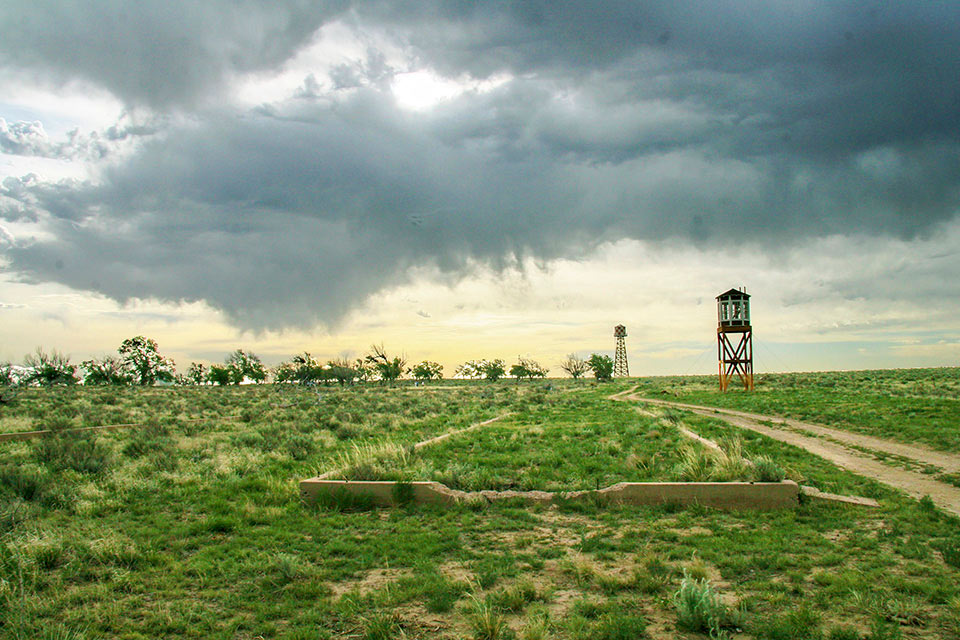
 Tule Lake War Relocation Center
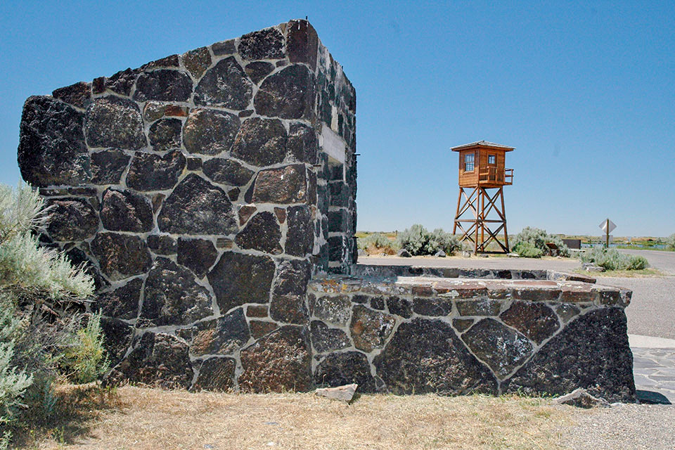
The Tule Lake War Relocation Center was located in northern California, 35 miles southeast of Klamath Falls, Oregon. With a maximum population of nearly 19,000, it opened in May 1942 on 7,400 acres of flat, treeless land that was formerly a lakebed. Literally miles of canals and drainage ditches were dug for farming, which also included raising chickens and hogs. The camp is most notable for having been converted to a maximum security segregation center in the summer of 1943, with more than 40% of the male detainees eventually classified as “disloyal” because they had answered “no” to certain questions on a government-issued questionnaire. After the conversion, the camp was guarded by additional troops, tanks were stationed at the camp, and additional guard towers, fencing, and search lights were installed. Many of the surviving structures at Tule lake are associated with the incarceration facilities—a stockade, jail, police area, remnants of guard towers and fencing. Just over 40 acres of the original camp were added to the National Register of Historic Places and designated a National Historic landmark in 2006.
 Topaz War Relocation Center
The Topaz War Relocation Center opened in central Utah, approximately 150 miles southwest of Salt Lake City, in September 1942. The detainees, numbering just over 8,000, were sustained by farming, with portions of the outlying 20,000 acres devoted to crops and the raising of turkeys, hogs, and cattle. They also created ponds and ornamental gardens and planted more than 7,500 trees and 10,000 shrubs. Nearly all the planted materials quickly died due to the widely varying temperatures and infertile soil of the flat, high-desert environment. Archaeological surveys have identified the remains of rock gardens and pools, along with the still-visible remnants of the roadway system, paths, gravel walkways among the barracks, and foundations of buildings. Three hundred acres of the original camp were added to the National Register of Historic Places in 1974, with a total of 730 acres named a National Historic Landmark in 2007. Some 630 acres of the site are now owned by the Topaz Museum Board, created in 1983. The Topaz Museum in nearby Delta provides a history of the site for visitors.
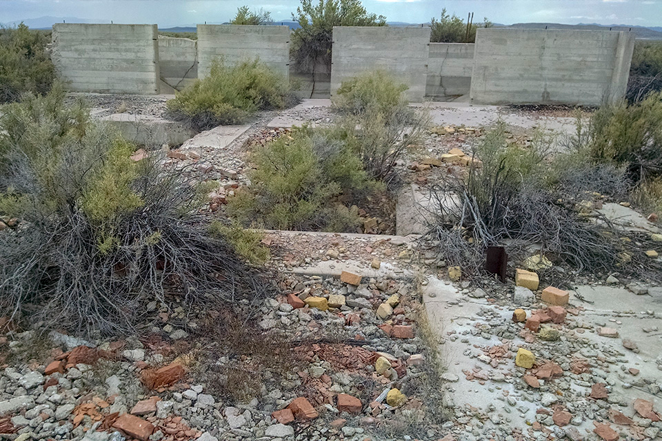
 Poston War Relocation Center
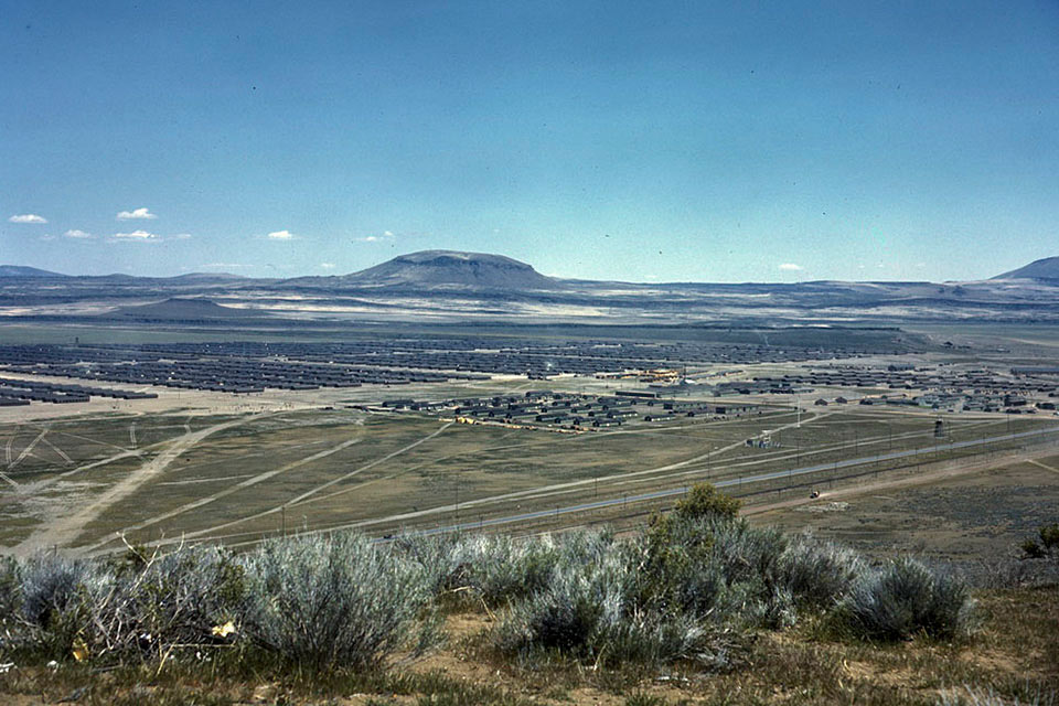
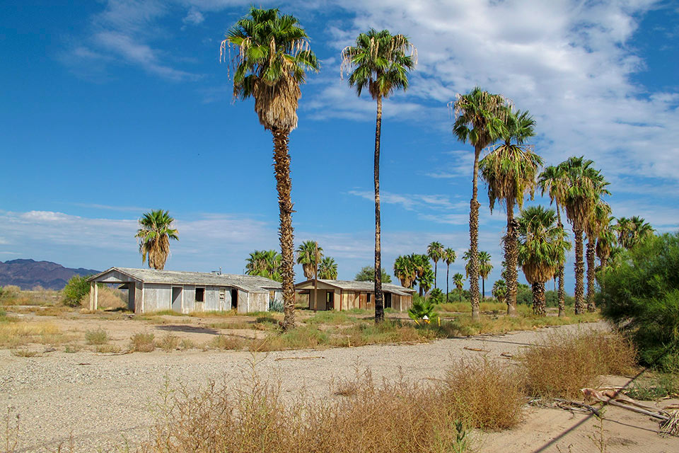
The Poston War Relocation Center was established in the remote Sonoran Desert 110 miles west of Phoenix, Arizona, just a few miles east of the Colorado River near the California border. The camp, which opened in May 1942 and housed nearly 18,000 detainees, was built on tribal land of the Colorado River Reservation. Without major highways nearby, the site of the Poston camp (like that of the Gila River camp) was so remote that it required no continuous circuits of fencing. The layout of Poston also differed, as it comprised three separate camps located three miles apart (Poston I, II, and III).
More than 2,000 acres of land were devoted to agricultural production, mostly of vegetables but also of field crops. The detainees beautified the site of the residential areas with ponds, gardens, and a swimming pool, while a nursery was constructed west of the barracks. Today, most of the land that comprised the camp and its ancillary fields is irrigated farmland. Among the prominent remaining structures at Poston are the adobe remains of the elementary school complex and its ten classroom buildings. The Colorado River Indian Tribes have set aside 40 acres of land for preservation, working with several Japanese American groups, including the Poston Community Alliance.
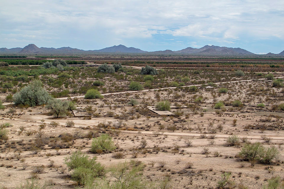 Gila River War Relocation Center
The Gila River War Relocation Center opened in July 1942 in Pinal County, Arizona, midway between Phoenix and Tucson. The site was leased from the Bureau of Indian Affairs and included tribal lands of the Gila River Indian Tribe, which objected to the incursion. Like the Poston camp, its remote location meant that a full circuit of guard towers and barbed wire was unnecessary. The Gila River center comprised two separate camps, the Butte Camp and Canal Camp. Approximately 500 acres of the surrounding area was planted in vegetables, along with flax and cotton. Cattle, hogs, and chickens were raised in abundance. The detainees, which numbered more than 13,300, also planted trees and created ponds and gardens. No standing buildings remain at either the Canal or Butte Camps. Foundations for some barracks and buildings are visible, along with evidence of irrigation ditches and landscape features. The site is sacred to the Gila River Indian Tribe, and public access to it is restricted.


What You Can Do to Help
1. Donate to the many non-profits that help maintain and preserve these sites. They include the Friends of Manzanar, Friends of Minidoka, Amache Preservation Society, Heart Mountain Wyoming Foundation, Tule Lake Committee, Topaz Museum, and Poston Community Alliance.
2. Visit the sites. Many have interpretive materials and a number of them have museums on or near the historic sites. Furthermore, most of them also offer annual Pilgrimages open to the public, which feature specialized programming and many former detainees returning to the sites of their confinement. Seek out educational curriculum that includes this important history to use in the education of the nation’s children.
3. Share your stories, documents, and artifacts relating to the WWII Japanese American experience. Many of the related museums seek to expand their collection of photos, letters, documents, artifacts, and audio-visual materials that illuminate this often-overlooked history. Consider conducting research, oral histories, or projects of your own.