

Landscape Information
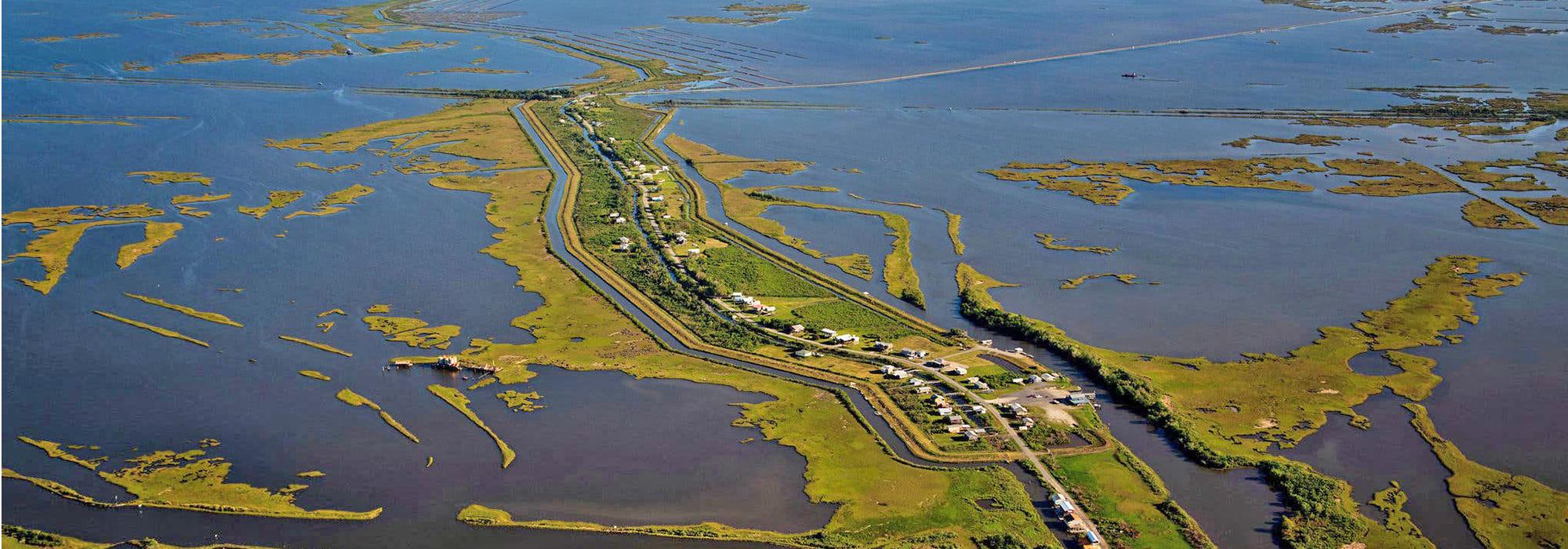
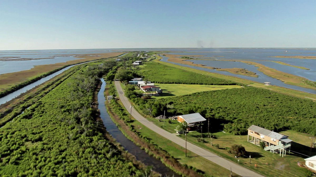
Located 80 miles southwest of New Orleans, this island first appears in oral histories as an uninhabited swamp. Initially reachable by wagon only during low tide, the Isle de Jean Charles remained effectively isolated from the mainland for more than a century, making it an ideal refuge for the native Biloxi-Chitimacha-Choctaw tribe in the wake of the Indian Removal Act of 1830. Thriving in a subsistence economy of fishing and farming, generations of Native Americans sustained a largely insular community through religious and educational institutions. The discovery of oil in the area in 1929 led to offshore drilling and canal dredging along the shoreline. Exacerbated by these activities, coastal erosion, subsidence, and rising sea levels have contributed to the loss of 98 percent of the island’s forested wetland since 1955.
The island once comprised 22,000 acres but is now a 320-acre strip of land surrounded by barrier islands, ridges, and natural levees. Built in 1953, the elevated Island Road forms the landscape’s central axis, connecting it to the mainland’s Pointe-Aux-Chenes. Wood-framed houses placed on stilts line the central road and the parallel bayou. Much of the dwarf palmettos, bald cypress, and sawgrass swamps that defined the island have disappeared along with the cow pastures and rice fields that once supported its inhabitants. Several community landmarks, including a school, a church, oyster shacks that once lined the bayou’s banks, and a grocery store that also served as the local dance hall, have also fallen victim to rising waters. Having been reduced to just 27 families, the island’s population has dwindled, and those who remain have been dubbed America’s first climate refugees, with plans now forming to resettle the community in Houma, Louisiana.


