

Transportation Project Places Mariemont at Risk

Located in Hamilton County, on the eastern outskirts of Cincinnati, Ohio, the Village of Mariemont was laid out by John Nolen with his associate Philip Foster as a response to increasing demand for housing after World War I. Considered Nolen’s magnum opus, the town, which was envisaged as a commuter community where working class citizens could enjoy a variety of housing choices including apartments, private homes, and townhouses, along with the amenities of local schools, shops and a hospital, was awarded National Historic Landmark status in 2007. Mariemont set an important precedent for town planning in the United States, through the introduction and adaptation of the tenets of Garden City design to the American way of life.
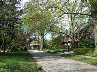
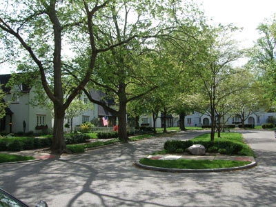
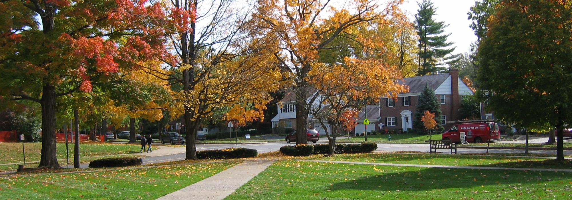
Mariemont, photos courtesy Karen Sullivan.History
On December 1, 1922, philanthropist Mary Muhlenberg Emery and her agent Charles Livingood founded the Mariemont Company to plan, build and operate Mariemont. The previous year, landscape architect and planner John Nolen had presented an initial plan for the village. His master plan, inspired by Garden City design ideals, which were gaining popularity abroad, assimilated many elements of the Garden City movement, including Ebenezer Howard’s concern for “unity of design and purpose” as noted in his book the Garden Cities of To-morrow. Along with a physical plan, Nolen developed a list of guidelines for town planning (published in New Towns for Old) which included the importance of geographic location, the necessity that the town’s design reflect both the cultural and physical attributes of the chosen site, and attention to local topography and other controlling natural features in the design.
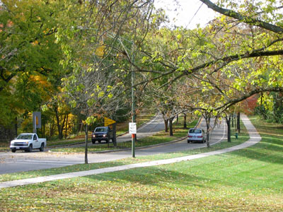
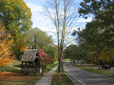
Nolen, who was an active participant from 1920 to 1925 in the town’s early development, created infrastructure, shaped public spaces and parks and created a unified vision for the village. His plans called for a naturalistic approach to the landscape, integrating pre-existing farmland and woodland into the design. His insistence that village utilities be buried to preserve views and his influence on the selection of architects for public and private buildings - which resulted in a diverse collection of homes that utilize a wide array of building materials, including fieldstone, brick, and white painted stucco – add to the community’s unique character. Many of his ideas were forward thinking: for example the streets in Nolen’s plan were designed to control vehicular circulation and speed without heavy reliance on stoplights and stop signs, a strategy that is emulated in contemporary Smart Growth best practices.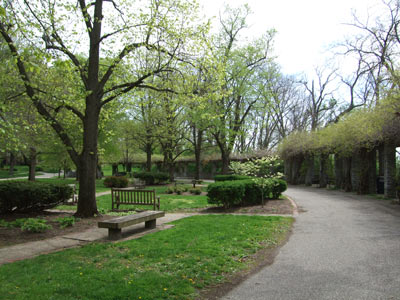
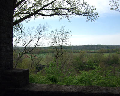
Views from Mariemont's stone concourse and bluff, photos courtesy
Karen Sullivan.The Village of Mariemont has an unusually high degree of historic integrity, partially attributable to the continued implementation of Nolen’s plan into the early 1960’s, despite the interruption of construction during World War II. The naturalistic open spaces critical to Nolen’s design have been maintained, and continue to play an important role in community life. While Nolen’s initial design encompassed 253 acres, subsequent purchases of land by the Mariemont Company expanded the community's size to its current 650 acres. Just ten miles from downtown Cincinnati; the square mile, self-contained village offers residents a rare connection to nature and the countryside in close juxtaposition with its urban neighbor.
Significant natural resources included in Nolen’s design were community gardens and fields in the Little Miami River floodplain, now part of the formally designated South 80 Park. The park is a significant resource for community residents and an example of the integral relationship between natural features and constructed elements in Mariemont. Above the park is a stone concourse and pergola at the edge of a bluff offering impressive views of the Little Miami River valley. The scenic views retain a remarkable similarity to the vista that inspired Nolen almost a century ago. The concourse, which was designed by Phillip Foster continues to be a place for community gatherings and events, a testament to the success of Nolen’s design and Mariemont’s commitment to preserving his intent. As a significant example of American Garden City design, Mariemont maintains a lasting influence on town planners, inspires design philosophies such as New Urbanism and Smart Growth, and demonstrates a successful alternative to suburban sprawl within the United States.
Threat
In August of 2012 the Ohio Department of Transportation publicly revealed a plan that proposed relocating route SR32 through Mariemont’s South 80 Park on the southern edge of the village. The proposition was part of the plan for the Eastern Corridor, a multi‐modal transportation project that would add a new bridge crossing the Little Miami River to create a four lane divided highway with substantial rights of way. South 80 Park provides the only public access to the Little Miami River within the Eastern Corridor study area. The park is a significant community and cultural resource, enjoyed by residents for its multiple passive recreational uses, and is also the site of important Native American artifacts. The transportation project would have significant negative, cumulative, impacts on this historic and cultural landscape.
 The extensive road construction will impact both the Village of Mariemont and the National Wild and Scenic Little Miami River Valley (a vital natural enclave, in an otherwise urbanized area). The highway will result in increased air, light, water and noise pollution and habitat fragmentation. Highway construction near the base of Mariemont’s bluff will likely compound current issues with erosion, possibly resulting in the destruction of the stone concourse, and a Native American serpent shaped embankment, believed to be the largest in the United States. Miles of highway will need to be elevated above the 100 year floodplain, further changing the landscape and natural flow of the watershed. Two potential remedies to the threat posed by the new road have been suggested by concerned organizations. The first is to construct alternative modes of transportation currently proposed in the Eastern Corridor plan – specifically a light rail and bike network. This may be sufficient to obviate the need for a new road. The second is to widen and improve existing roadways in lieu of constructing an elevated highway through the scenic river valley and celebrated historic community.
How to Help
Regional organizations, including the Cincinnati Preservation Association, The Hillside Trust, Heritage Ohio, and the Mariemont Preservation Foundation have committed to assist with efforts to preserve Mariemont. Despite growing opposition, the Ohio Department of Transportation (ODOT) continues with plans to locate the Eastern Corridor project highway through South 80 Park and the National Wild and Scenic Little Miami River Valley.
Individuals interested in getting involved can show their support for efforts to forestall construction of the road by signing the on‐line petition at Change.org. Letters and notes of concern can be sent to the project implementation partners at Hamilton County, ODOT, Federal Highway Administration, Clermont County, the City of Cincinnati, and the Ohio, Kentucky, Indiana Regional Council of Governments (OKI) in opposition of ODOT’s plans (contact info at http://easterncorridor.org/overview/implementation-partners/) or posted on the Eastern Corridor Facebook page.
References
Rogers, M. F. John Nolen and Mariemont: Building a New Town in Ohio. 2001. John Hopkins University Press, Baltimore and London.
National Register of Historic Places, Village of Mariemont, Hamilton County, Ohio, National Register #430271.
Related Content

Mariemont
Mariemont, OH