Established in 1937 and covering some 70 miles of unspoiled barrier islands along North Carolina’s Atlantic Coast, the Cape Hatteras National Seashore—the nation’s first national seashore—occupies a unique place in Native American, colonial, and maritime history, connecting events of great historical importance, from the first English settlement to the German U-boat attacks of World War II. But this thin strip of land that is also a vacationer’s paradise is being consumed by rising waters and battered by storms of ever-growing intensity, placing in doubt the survival of the immense cultural and natural resources it contains.
History
Managed by the National Park Service, the Cape Hatteras National Seashore is part of the 200-mile-long string of barrier islands known as the Outer Banks, which front most of the North Carolina coastline and a portion of southeastern Virginia’s. The area occupied by the National Seashore was originally inhabited by the Carolina Algonquians, the southernmost speakers of the Algonquian language who were distributed from the Neuse River in North Carolina to the coastal provinces of Canada. The Algonquian nation of Croatoan Indians lived on Hatteras Island, their capital located at what is presently the Town of Buxton. The Roanoke Nation occupied lands farther north on what is today Roanoke Island and the Dare mainland.
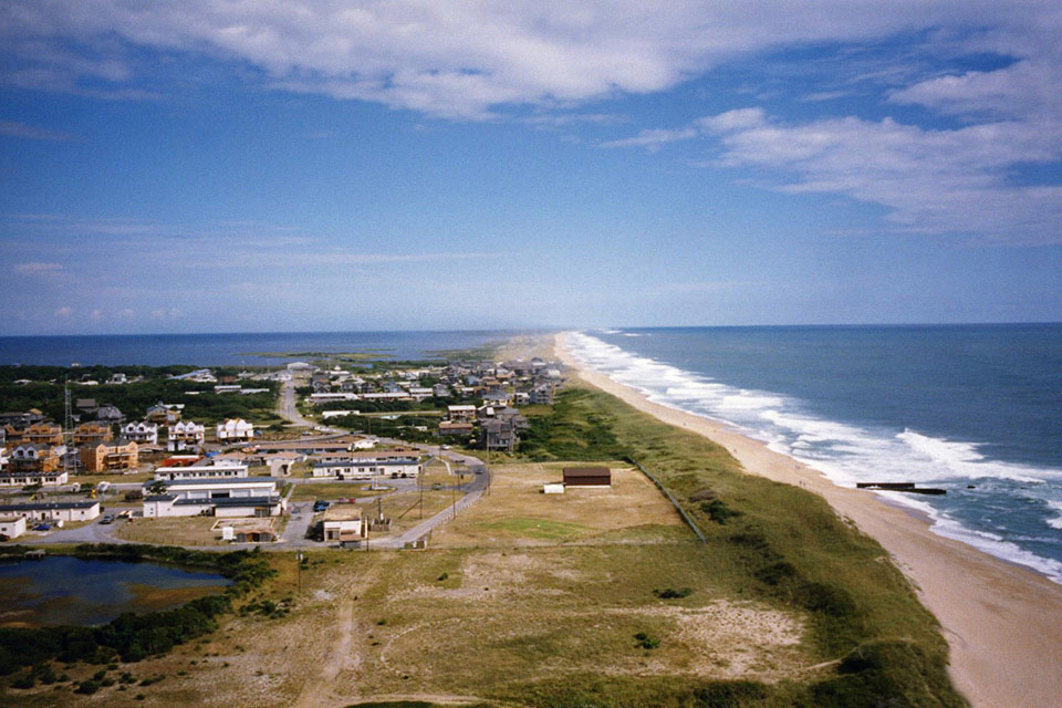
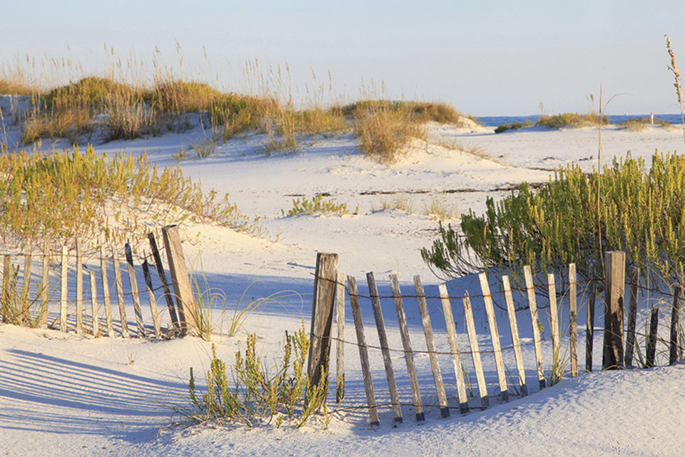 North Carolina’s Outer Banks is famous for its white sand beaches; photo courtesy Outer Banks Forever, 2019.
Two ships anchored off this stretch of coastline in July of 1584 signaled the colonial interest of the English Crown and the personal ambition of Sir Walter Raleigh. Arthur Barlowe, captain of one of the ships, gave a description of an encounter that amounts to the first written history of the Roanoke and Croatoan Indians:
"My self[e] with seven more went twentie mile into the River that runneth toward the Citie of Skicoak, which River they call Occam, and the evening following wee came to an Island which they call Roanoak, distant from the harbour [inlet] by which we entered seven leagues. At the North end thereof was a village of nine house, built of Cedar, and fortified roundabout with sharp trees to keep out their enemies, and the entrance into it made like a turne pike very artificially. When we came towards it standing neere unto the waters dide, the wife of Granganimo, the king’s brother, came running out to meete us very cheerfully and friendly. Her husband was not then in the village…"
Barlowe’s discovery led to future expeditions likewise funded by Raleigh, who sent a group of colonists to Roanoke Island in 1585 under the command of Governor Ralph Lane. But lacking sufficient provisions, the group returned to England in 1586, abandoning the colony. Undaunted, Raleigh sent forth a second troop of colonists in 1587 under the command of John White. White returned to England for supplies later that year, leaving among the settlers his wife, his daughter, and his new granddaughter, Virginia Dare, the first child born to English parents in the New World. But when he returned to Roanoke Island in 1590, having been delayed by England’s war with Spain, his family and the other colonists had completely vanished, giving rise to the enduring mystery of the "Lost Colony of Roanoke,” whose fate still remains unknown.
The colorful history of the area continued into the seventeenth century, when the barrier islands were used by pirates to store gold and goods plundered from Spanish and British ships. The many hidden coves and inlets near Hatteras provided perfect cover, with Ocracoke Island serving as the headquarters of the legendary Edward Teach (alternatively, Thatch), better known as Blackbeard. Although Blackbeard’s capture in 1718 brought an end to the era of piracy along the Outer Banks, the many treacherous shoals and numerous shipwrecks—more than 5,000 since records have been kept—have earned it the nickname “Graveyard of the Atlantic.”
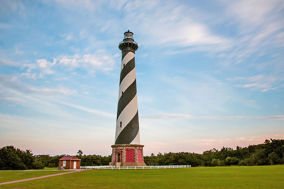
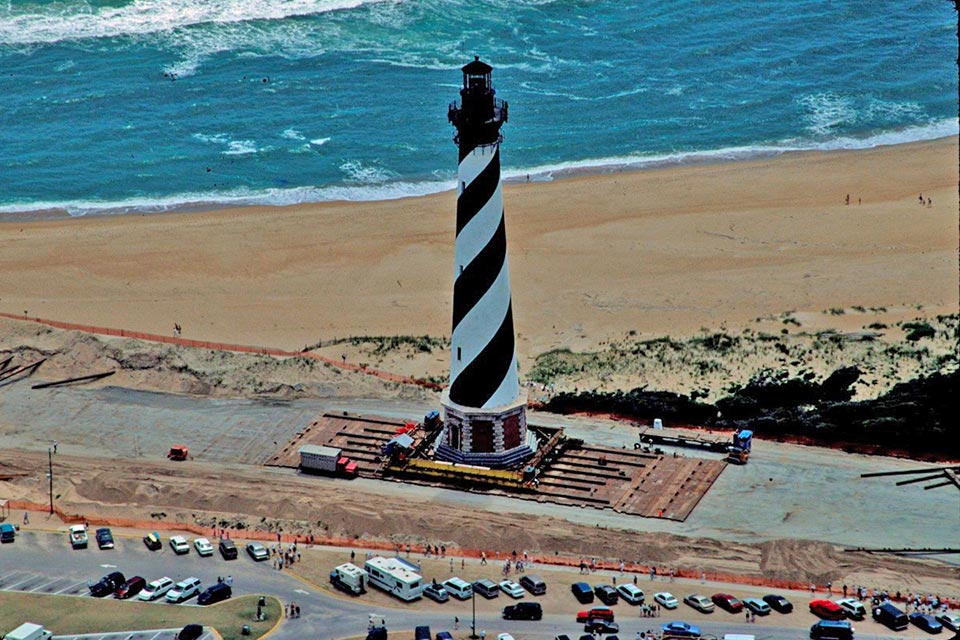 In 1999 the Cape Hatteras lighthouse was relocated nearly 3,000 feet from its original site; photo courtesy National Park Service, 1999.
A symbol of the will to persevere amid these perilous conditions is the black-and-white-striped Cape Hatteras lighthouse, easily the most recognizable landmark on the National Seashore. First lit on December 1, 1870, the 208-foot-high lighthouse is the tallest brick-made lighthouse in the world. It replaced a considerably shorter sandstone structure erected in 1803, which proved ineffective against the deadly Diamond Shoals. After more than a century of faithful service, the newer Hatteras lighthouse faced a peril of its own: By the late 1980s it has become clear that beach erosion would soon undermine the structure, which, in a remarkable feat of engineering, was moved nearly 3,000 feet inland in 1999.
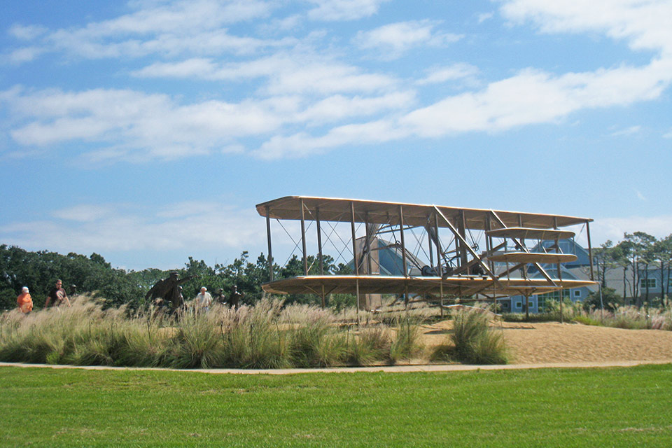
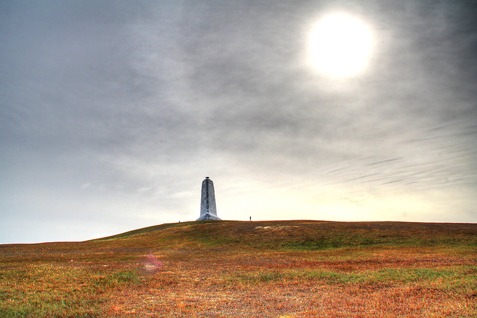
During the late nineteenth century, the shoreline became a recreational destination frequented by hunters and fishermen, signaling its inhabitants’ future shift from subsistence living to a more commercialized economy, as developments in the early twentieth century would further integrate the Outer Banks with the mainland. Between 1901 and 1902, Reginald A. Fessenden successfully transmitted wireless messages from Roanoke Island to Cape Hatteras and Cape Henry, forever altering the trajectory of human communication. And in 1903 the Wright brothers similarly altered the trajectory of human transportation, flying the first controlled, powered plane from the dunes of Kitty Hawk, just north along the coast from the Hatteras lighthouse. This narrow stretch of coastline would once again make headlines as Germany launched Operation Paukenschlag in 1942—a strategic submarine assault on the U.S. eastern seaboard that sank 397 ships in just six months. So many merchant ships were sunk in proximity to Cape Hatteras, an important navigational feature, that the area became known as "Torpedo Junction."
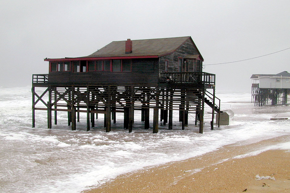 An elevated dwelling in Kitty Hawk, NC, weathers Hurricane Dennis; photo by Dave Gatley, 2005.
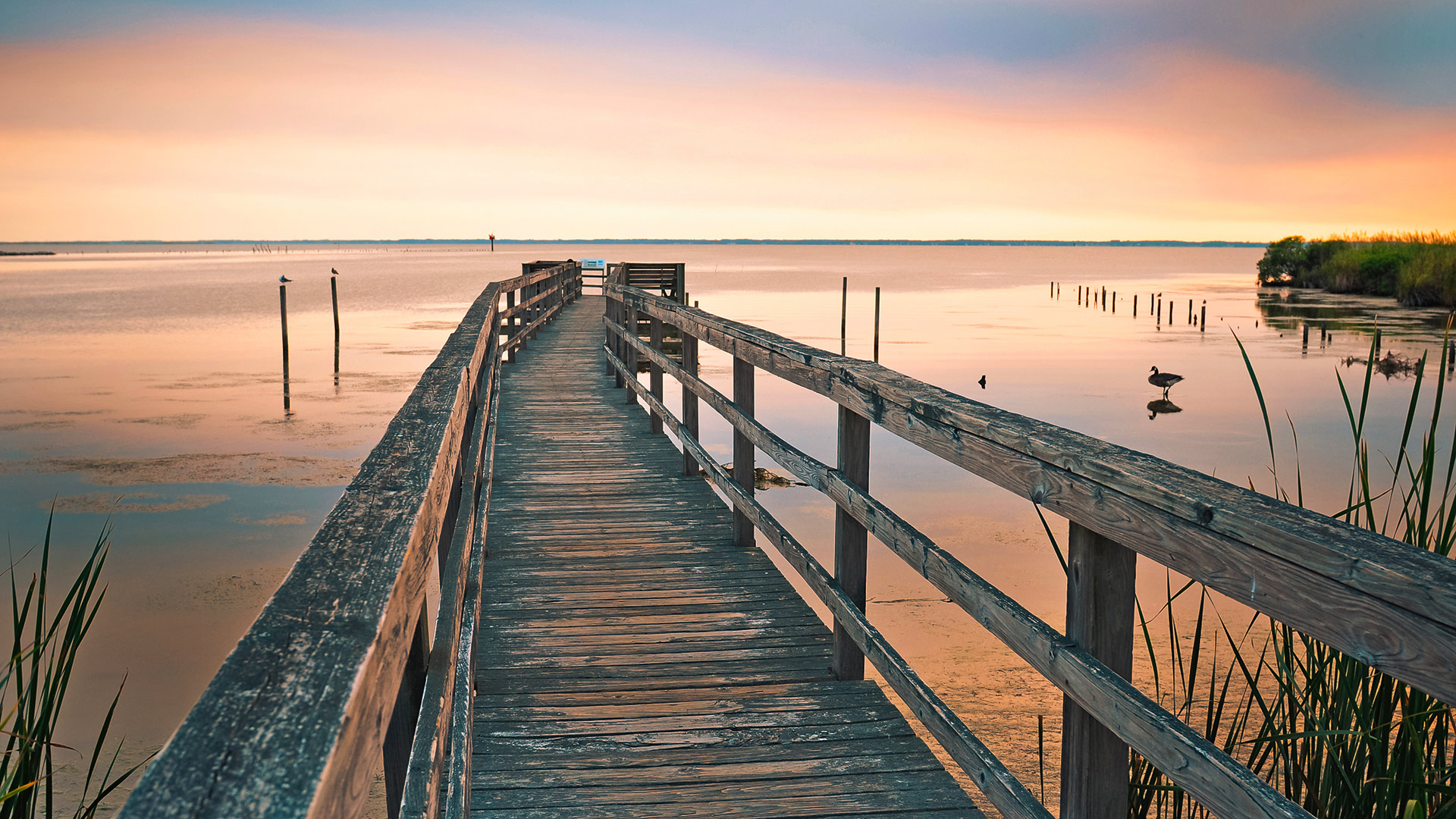
A discontinuous landscape, the Cape Hatteras National Seashore is formed by a series of bow-shaped barrier islands. Technically speaking, barrier islands are narrow, low-lying, dynamic landforms that run parallel to ocean coasts, separated from the mainland and constantly moving and morphing in response to storms, ocean currents, sea-level changes, and wave and wind action. These processes continue to influence the islands today, as is evident in the erosion and accretion of the shoreline, over wash across the islands, and the formation, migration, and closure of the inlets.
The linear Ocracoke Island forms the southernmost tip of the landscape, comprising beaches, dunes, maritime forests, salt marshes, and shrub thickets. Immediately to the northeast lies Hatteras Island, encompassing the Buxton Woods Coastal Reserve, where the Hatteras lighthouse is located. The National Seashore is also an area of great natural beauty, supporting several threatened and endangered species, including the piping plover and loggerhead sea turtle. Along with the Fort Raleigh National Historic Site on the northeastern tip of Roanoke Island, and the Wright Brothers National Memorial at nearby Kill Devil Hills, it completes a triad of national parks that preserves and interprets this cultural landscape’s complex and intertwined history.

Threat
The first report to outline the risk to the three Outer Banks national parks was conducted in 1988 by the National Council of Research. More recently, according to an NPS report on sea-level rise and storm surge projections, the coastline along the parklands will experience the highest average rate of sea-level change by the year 2100, based on historical data and information from the National Oceanic and Atmospheric Administration (NOAA). The immense damage inflicted by hurricanes Sandy (2012), Matthew (2016), and Harvey, Irma, and Maria (all in 2017) indicates the need to identify and mitigate future vulnerabilities. The rate of erosion from sea-level rise has accelerated each year over the past decade. It not only threatens the Cape Hatteras National Seashore but the other two national parks as well. Data from NOAA show that the relative sea level trend is +4.69 millimeters per year in the Outer Banks.
Thus, one of the most imminent threats to the Cape Hatteras National Seashore is to the natural habitat it protects. As sea level rises, erosion rates increase and the natural habitat between the ocean and the waterfront properties decreases. This also poses a threat to the historic structures at the Seashore, as well as to the visitor access that is a crucial part of the park’s mission. Today the park is struggling to save other infrastructure from further damage, including the roadway at the Ocracoke Island Ferry. Saving the ferry terminal area is crucial because the ferry is the only way to access this southernmost section of the park.
In addition to the unique natural and cultural resources found at the Cape Hatteras National Seashore, the landscape is deeply and directly connected to the local economy. In 2018 the three national parks in the Outer Banks unit saw a combined 3.2 million visitors and contributed some $203.1 million in revenue to communities near the parks, in addition to providing 2,947 jobs to local residents. The cumulative annual benefit of the parks to the local economy is on the order of approximately $255.4 million.

What You Can Do to Help
The National Park Service and local governments are working together to explore natural and man-made infrastructure projects that may stem the rate of erosion at the National Seashore. In addition, the Nature Conservancy’s Coastal Resilience project gives the parks several tools and potential natural solutions to explore, including protecting or restoring area salt marshes as buffers and designing restored oyster reefs to serve as breakwaters.
The Outer Banks group of parks is currently updating its general management plans for all three park locations, with an emphasis on long-term projections of the effects of sea-level rise. The newly formed Outer Banks Forever is the official non-profit partner of the parks and is supporting them by engaging visitors through philanthropy, education, volunteerism, and partnerships.
Support Outer Banks Forever and its work to help plan and implement solutions that will engage and enlist the public in the stewardship of this treasured cultural landscape.